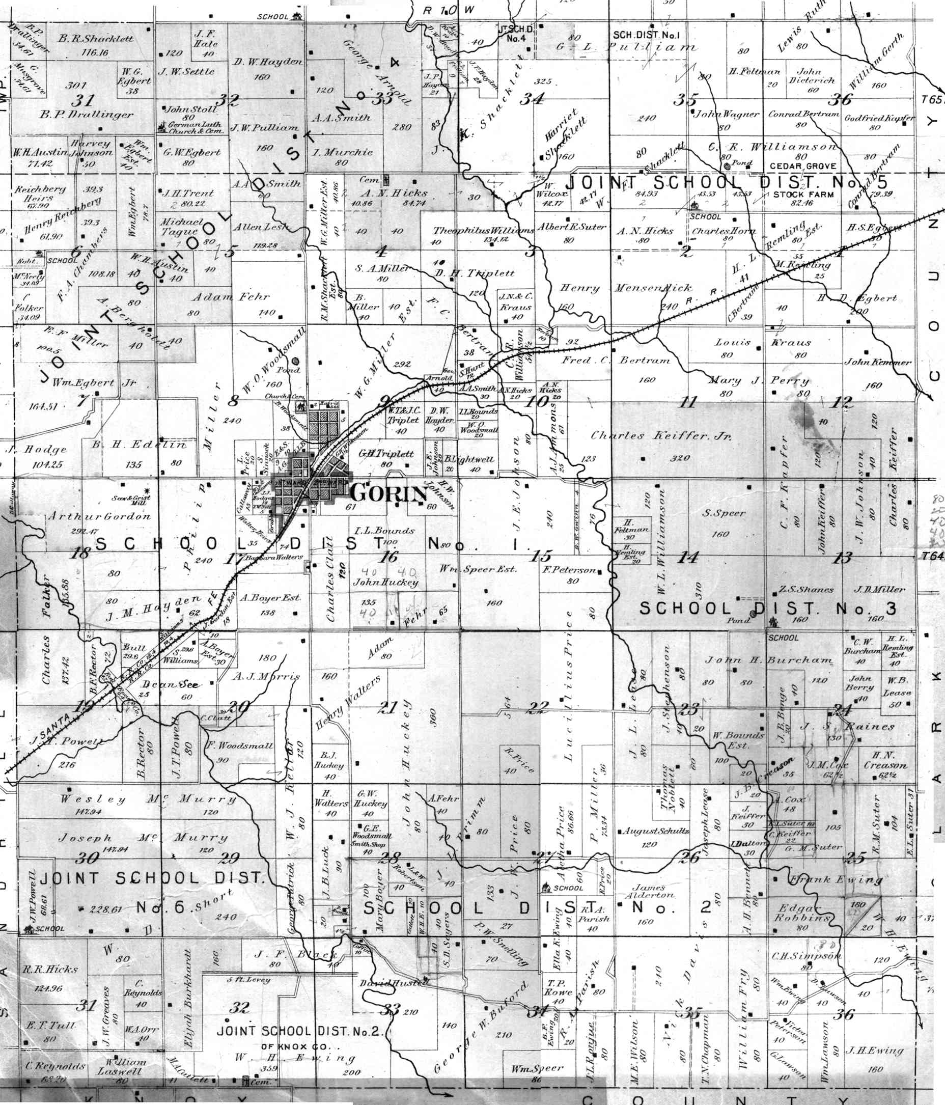
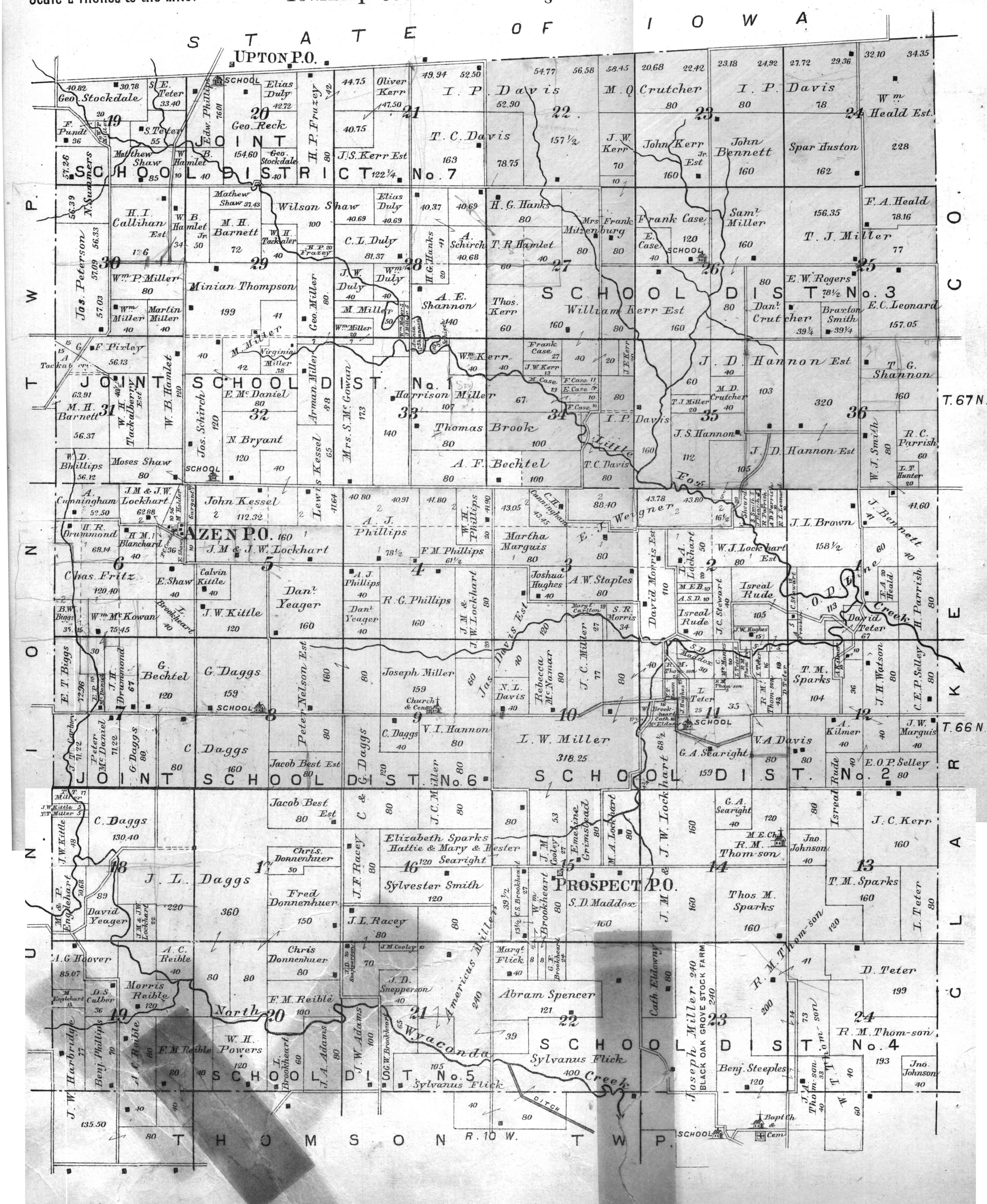
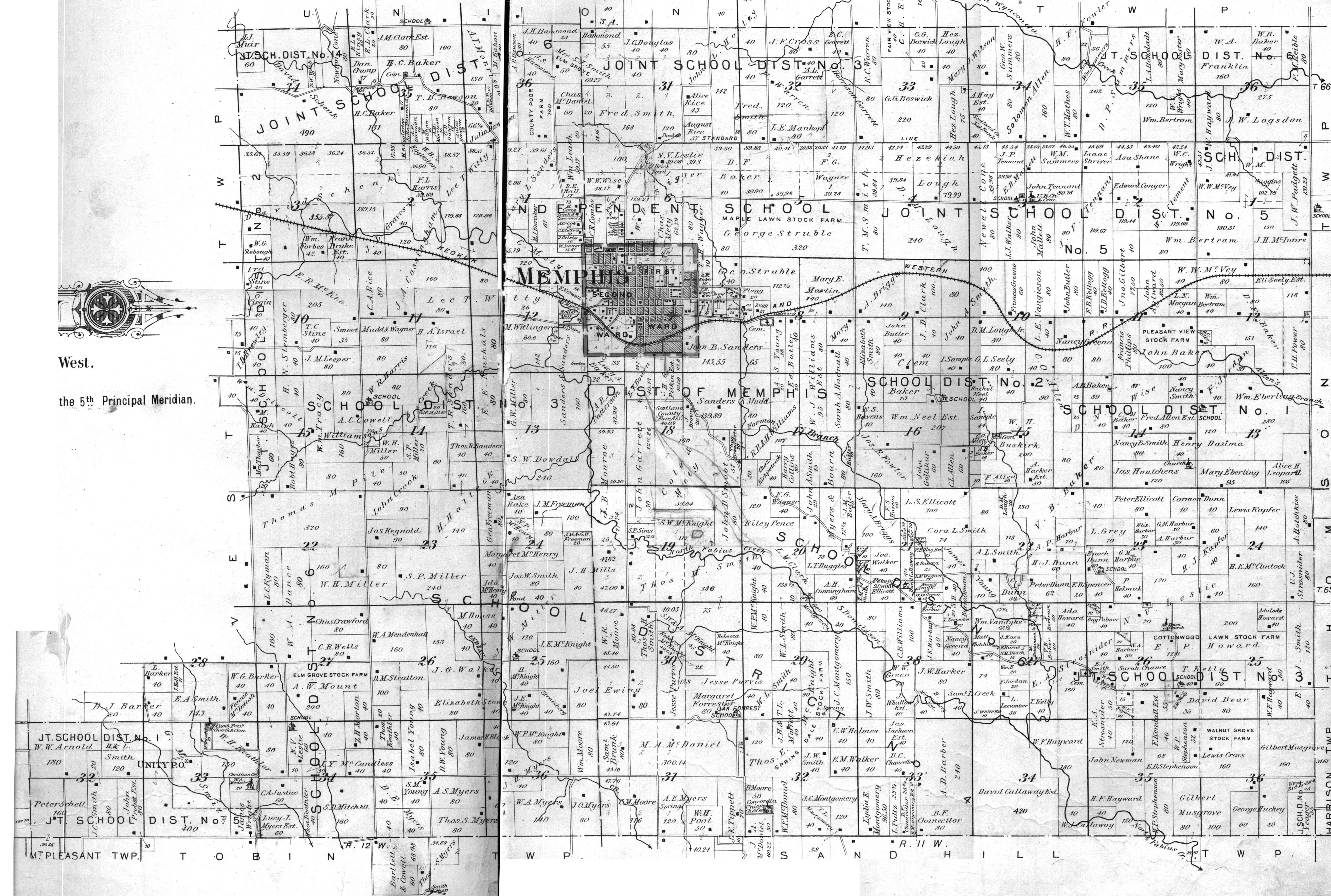
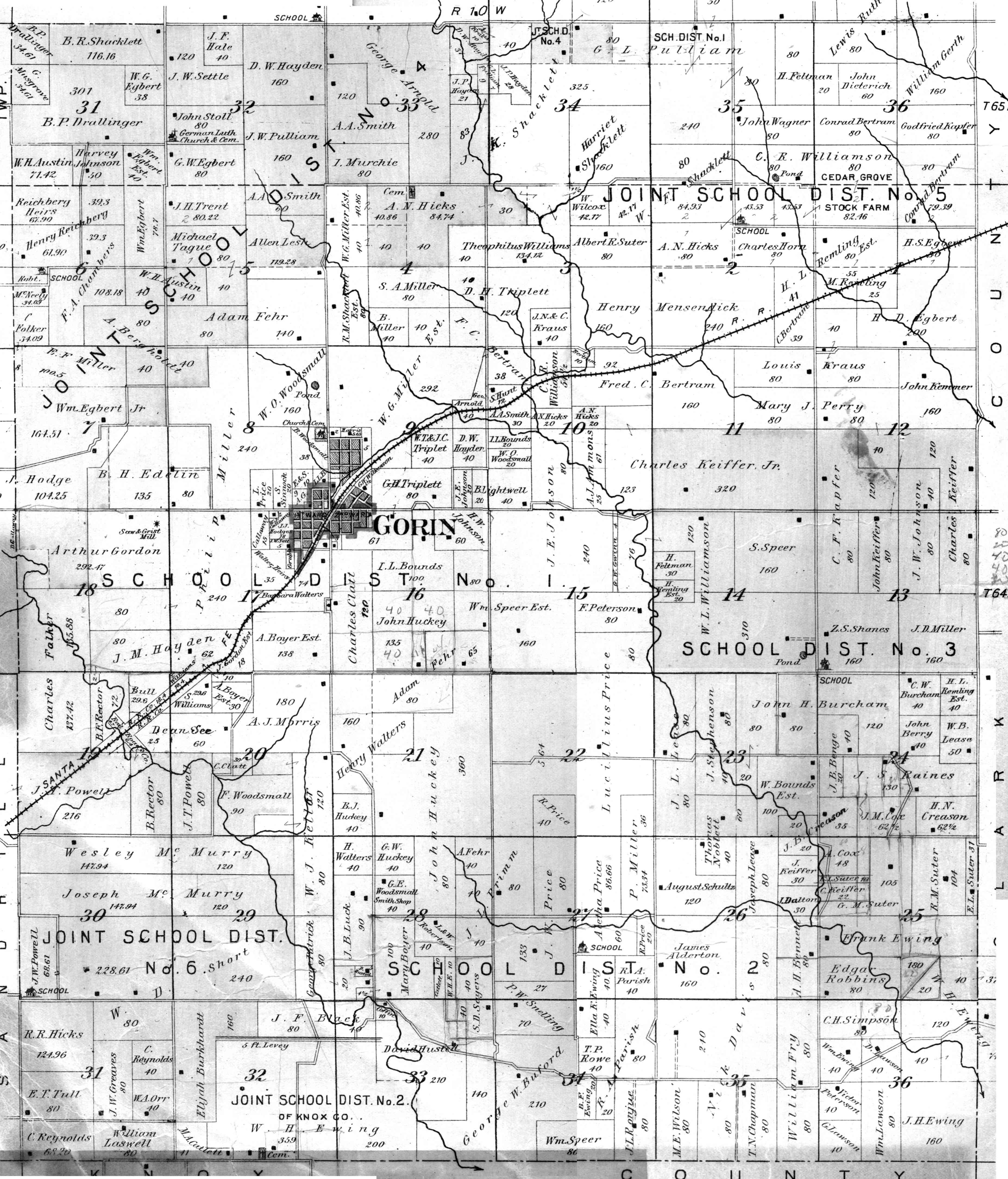
Plat maps show all the land of the county, as well as the owner of the land. It is assumed that this map was prepared about 1898 from the legal ownership of land as shown in the official real estate records for Scotland County, Missouri. Please note that these maps show who owned the land, not who lived there, if anyone. In many cases, the owner may have lived elsewhere and simply rented the land to someone else.
The thumbnail maps shown below are arranged so that, if put together, they would represent all of Scotland County, Missouri.
The top map is of the entire county. Feel free to browse all the maps, but if you know the part of the county where your ancestors lived, you may want to look at this map first. Locate the area you are interested in and then identify the political township involved. You can then identify the labeled map, from the county map.
The maps which follow the county map are arranged such that the upper left hand map (Miller Township), represents the northwest corner of the county, and the lower right map, represents the southeast corner of the county.
Place your cursor over any one thumnail map and click, you will be taken to the corresponding full scale map. In addition, if you'd like to look at a map with even greatly detail, there is a link under the thumbnail map for a really big map. While the detail is much finer, the size of these maps is huge. Depending on your browser configuration, your computer may choke on these big maps.
Note: These maps are likely larger than your screen. I'm sorry about that, but when I tried to reduce them to screen size, they were simply not readable.
If you are interested in understanding how this survey stuff works, take a look at this page. I think it will help you understand plats.
(COMING SOON) A great Surname Index has been created by Jim Thomas and can be found by clicking on the index link directly below: Surname Index Here

Whole County
|
|
| |
|
|
| |
|
|
|
|
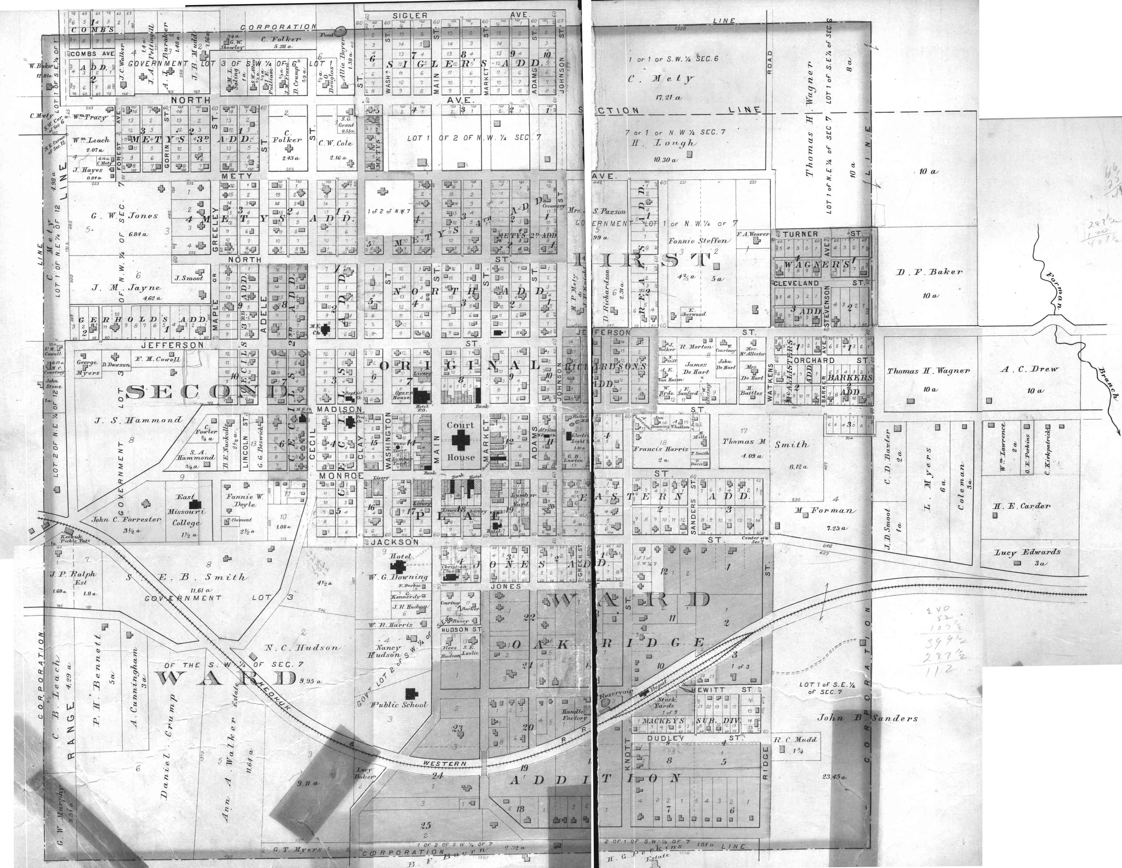
In addition to the plat of the rural land, the 1998 plat map set also included plat for the various towns within the county. The landowners around the fringe of the towns are lists so I thought it important that they be included. However, for the most part, these plats do not include the names of the landowners, but if you have the legal description for your subject's land, you can see where in the town your subject lived. Just click on the town below and you will be taken to the plat map for the town. There is a link to a larger map just after the town name.
Bible Grove, (big map here)
Kilwinning, (big map here)
Page last updated March 20, 2001


